Sagebrush Treatment on the Plateau North of Cerro: What Questa Neighbors Should Know
Wednesday, November 4, 2026
Wednesday, November 4, 2026
Tuesday, November 3, 2026
If you are driving around Questa today, the weather is on your side. It was clear and cold early this morning, around 34 degrees, with sunny skies ahead and a high near 52 degrees. There are no weather alerts in effect for Questa or Taos County, sunrise was at 6:28 AM and sunset comes at 5:03 PM, so plan mountain driving with that early darkness in mind, especially on shaded curves where a cold morning can leave the pavement slick long after the sun is up.
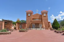
Did you know Questa's church began in the same year as the village itself? When 35 families received possession of the San Antonio del Rio Colorado land grant in January 1842, the village they founded took its name from Saint Anthony — San Antonio del Rio Colorado, Saint Anthony on the Red River. Construction of the San Antonio church began that same year, in 1842, and the first baptism records from Rio Colorado date to 1842 as well. This was no quick building project. The church would take years to finish, and that long, patient work is part of its story.
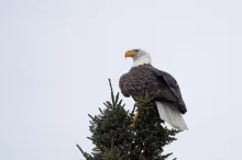
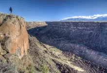
Early November is when a patient look upward starts to pay off north of Questa. The Rio Grande Gorge, protected within the Rio Grande del Norte National Monument, is home to two very different eagles. Golden eagles live here all year, riding the thermals that rise off the basalt walls. Bald eagles are the winter guests: the monument's founding proclamation notes that bald eagles roost above the river in winter, then fly out over the sagebrush of the Taos Plateau. As northern waters freeze, more of them follow the river south into our stretch of the gorge.
Monday, November 2, 2026
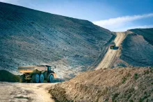
Did you know that for a time, Questa's molybdenum mine did not sleep at all? After the old high-grade underground veins ran out and underground mining ceased in the late 1950s, years of drilling told a new story. By 1964, exploration begun in 1953 had outlined a large tonnage of low-grade ore just west of the underground workings, ore that could be mined from the surface. It was a completely different kind of mine from the one Questa's first miners had known, and it would reshape work, and the mountain, for a generation.
Sunday, November 1, 2026
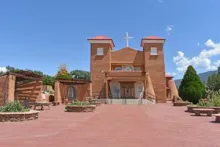
Rain is falling over the valley this Sunday, with a high near 55 degrees, rain likely through the day, and sunset coming early at 5:05 PM now that the clocks have gone back. It is a good day to slow down, stay close to home, and look again at the place that has stood at the center of Questa longer than the village has carried its present name: the thick-walled adobe church on the old plaza, St. Anthony's.
Saturday, October 31, 2026
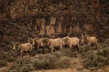
There is no better place to spend a crisp fall Saturday near Questa than the rim of the Rio Grande Gorge at the Wild Rivers Recreation Area, in the heart of the Rio Grande del Norte National Monument. This morning starts cloudy and cool in the village, in the low 40s, before skies turn partly cloudy and the afternoon high reaches the mid-50s — fine weather for a slow drive out to the overlooks, a rim walk, and some patient wildlife watching.
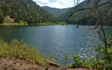
East of Questa, one of the village's favorite backroads leaves the highway and climbs into the Carson National Forest. Cabresto Canyon follows Cabresto Creek up through pine and aspen, and the drive ends, for motorized travel, at a small mountain lake tucked under high peaks. It is an easy road to describe and a rewarding one to drive slowly, with the creek, the canyon walls, and the changing light doing most of the work.
Copyright © 2026 Rocky Mountain Madman LLC - All rights reserved
Developed and Designed by Rocky Mountain Madman LLC