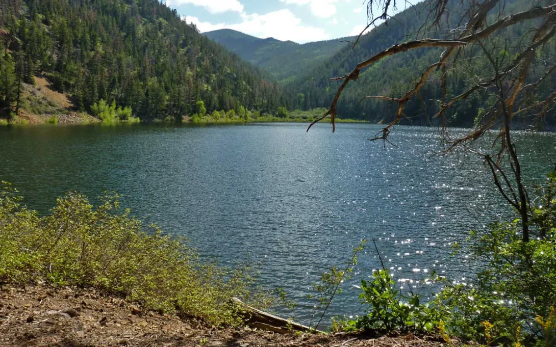
East of Questa, one of the village's favorite backroads leaves the highway and climbs into the Carson National Forest. Cabresto Canyon follows Cabresto Creek up through pine and aspen, and the drive ends, for motorized travel, at a small mountain lake tucked under high peaks. It is an easy road to describe and a rewarding one to drive slowly, with the creek, the canyon walls, and the changing light doing most of the work.
The Forest Service gives the route plainly: from Questa, travel five miles northeast on Forest Road 134, then two miles north on Forest Service Road 134A, and the last two miles are a primitive road. Visit Questa's directions start the same climb from behind the village Visitor Center, where Cabresto Road becomes NM 563 and then Forest Road 134, and they recommend four-wheel drive or a high-clearance vehicle for that final stretch to the lake. Take that advice seriously, go slowly, and expect a rough, rocky surface near the top rather than a smooth finish.
The reward at the end is Cabresto Lake. The Forest Service describes its small campground there as four semi-dispersed campsites at 9,500 feet, overlooking the lake from a level ridge, and lists the site as open. The lake is one of the few places in New Mexico where visitors might catch a brook trout, and non-motorized boats are allowed, with single-person kayaks or inflatables the largest craft the Forest Service recommends. The same parking area serves the Lake Fork Trail, which continues on foot into the Latir Peak Wilderness, where motorized travel ends.
Late October is a fine time to make this drive with your eyes open. The Forest Service seasonal-restrictions page, checked this week, shows no seasonal vehicle designations currently in effect, but it also warns that restrictions and closures can happen unexpectedly. At 9,500 feet, weather can turn quickly, and a road that was pleasant in the morning can be muddy, icy, or snow-dusted by afternoon. Check the forecast before you leave Questa, carry warm layers and water, tell someone where you are going, and turn back without regret if the surface stops looking like fun.
Know before you go: Stay on designated routes only. Forest Roads 134 and 134A are shown on the Carson National Forest Motor Vehicle Use Map for the Questa Ranger District, which is the official map for motorized travel in this forest, so carry that map and follow it rather than a shortcut or a track that looks well used. Check current Forest Service alerts and closures before going, because conditions and restrictions can change without much notice. Practice Tread Lightly travel: drive slowly, stay on the road surface, and leave creek banks and meadows unmarked. Respect gates and private land along the way, pack out everything you pack in, and leave Cabresto Canyon ready for the next driver who climbs it.