Skip to header Skip to main navigation Skip to main content Skip to footer

Search form

Home
Questa New Mexico

Main navigation

  • Home

Scenic Drives

Breadcrumb

  • Home
  • Scenic Drives

Clear Roads Around Questa, Wet and Windy Drive-Ins From Kansas and Colorado
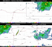
A composite radar image showing clear conditions over northern New Mexico and the Enchanted Circle, heavy rain across northern and central Kansas on I-70 and toward Dodge City, storms east of Wichita, and rain across the Colorado Front Range on I-25 through Denver and Fort Morgan.

Tuesday, November 3, 2026

If you are driving around Questa today, the weather is on your side. It was clear and cold early this morning, around 34 degrees, with sunny skies ahead and a high near 52 degrees. There are no weather alerts in effect for Questa or Taos County, sunrise was at 6:28 AM and sunset comes at 5:03 PM, so plan mountain driving with that early darkness in mind, especially on shaded curves where a cold morning can leave the pavement slick long after the sun is up.
  • Read more about Clear Roads Around Questa, Wet and Windy Drive-Ins From Kansas and Colorado

Cabresto Canyon by Forest Road 134: Questa's Backroad to a High Mountain Lake

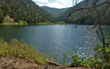
A photograph of Cabresto Lake below forested peaks in the Carson National Forest northeast of Questa, New Mexico.

East of Questa, one of the village's favorite backroads leaves the highway and climbs into the Carson National Forest. Cabresto Canyon follows Cabresto Creek up through pine and aspen, and the drive ends, for motorized travel, at a small mountain lake tucked under high peaks. It is an easy road to describe and a rewarding one to drive slowly, with the creek, the canyon walls, and the changing light doing most of the work.

  • Read more about Cabresto Canyon by Forest Road 134: Questa's Backroad to a High Mountain Lake

NM 522: The Carlos R. Cisneros Memorial Highway

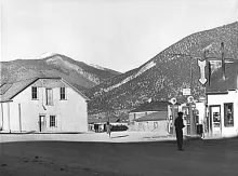
John Collier Jr.'s 1943 photograph of the highway junction in Questa, with a gas station and the J.A. Rael Hall.

Every drive north from Questa follows a road with layers of history under its pavement. Today that highway, NM 522, also carries a name that honors one of Questa's own: in 2022, it was named the Senator Carlos R. Cisneros Memorial Highway.

Carlos R. Cisneros was a Questa man who served 34 years in the New Mexico Senate, from 1985 to 2019. Thirty-four years is an extraordinary span of public service, covering decades of change in New Mexico. Naming the highway north from his hometown for him ties his long career in Santa Fe back to the road home to Questa.

  • Read more about NM 522: The Carlos R. Cisneros Memorial Highway

NM 38 East from Questa: Over Bobcat Pass on the Enchanted Circle

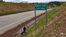
The Bobcat Pass summit sign on NM 38 reading Elev 9820, photographed for a CycleBlaze cycling journal.

Every great mountain drive has a beginning, and for travelers heading east from Questa, it begins on NM 38. The highway was named by 1912 for the Questa-to-Eagle Nest route, a road tying the village to the Moreno Valley. More than a century later, it remains the way east: out of Questa, into the canyon, and up toward the high country.

  • Read more about NM 38 East from Questa: Over Bobcat Pass on the Enchanted Circle

Old Red River Pass: The Road That Opened the High Country

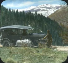
A 1920s Dodge touring car on the old Red River Grade, with snowy peaks behind the pines.

Before 1915, getting over Red River Hill was an ordeal that wagon drivers planned their whole trip around. The old road climbed at grades as steep as 27 percent, far beyond what a loaded wagon could safely descend on its own brakes. Drivers coped the frontier way: they cut a log, chained it behind the wagon, and dragged it down the mountain as a brake, trusting friction and timber to keep them alive.

  • Read more about Old Red River Pass: The Road That Opened the High Country
Subscribe to Scenic Drives

Copyright © 2026 Rocky Mountain Madman LLC - All rights reserved

Developed and Designed by Rocky Mountain Madman LLC