Saturday, November 7, 2026
A cold, bright Saturday has settled over Questa, and it is a fine morning to look for wildlife in the wide country west and north of the village. The day began clear at 28 degrees, and sunny skies will carry the temperature into the mid-50s, with sunrise at 6:32 a.m. and sunset at 4:59 p.m. and no weather alerts in effect. On mornings like this, the sagebrush plateau above the Rio Grande Gorge holds long, clean light, and animals that spend the colder months on the open ground are often easiest to spot in the first and last hours of the day.
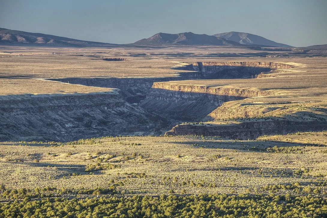
The plateau is genuine winter range. The Rio Grande del Norte National Monument protects about 243,000 acres of public land managed by the Bureau of Land Management, where rugged plains at an average elevation of about 7,000 feet are dotted with volcanic cones such as Cerro de la Olla and Cerro del Yuta. Rocky Mountain elk, mule deer, pronghorn, and Rocky Mountain bighorn sheep find their winter homes on that plateau, alongside a population of Gunnison's prairie dogs in the sagebrush and native grasslands. A slow drive and patient glassing from the rim country can turn up herds moving between feeding and resting ground, although every sighting is a gift rather than a promise.
The gorge below tells a different wildlife story. The Rio Grande has carved a gorge as much as 800 feet deep through layers of volcanic basalt flows and ash, and at the Wild Rivers Recreation Area the Rio Grande and the Red River come together beneath La Junta Point. The monument lies on the Central Flyway, a vital migration corridor for birds such as Canada geese, herons, sandhill cranes, hummingbirds, and American avocets, and bald eagles roost above the river in winter. Deep in the canyon, the Bureau of Land Management notes, the descent from rim to river creates a unique diversity of plant and animal life in a space that looks almost empty from above.
East of the village, the Columbine-Hondo Wilderness offers the mountain counterpart to the plateau and the gorge. Designated in 2014 and managed by the Forest Service within the Carson National Forest, its 44,372 acres hold the headwaters of the Rio Hondo and the Red River, streams that supply water to downstream communities including Questa. Its lush forests and alpine meadows are home to mule deer, elk, black bears, and mountain lions, and above treeline, bighorn sheep share a fragile alpine tundra with marmots and pikas. Together, the plateau, the gorge, and the high basin form one connected landscape, and wildlife moves through all of it with the seasons.
Visitors who head out today should plan around one standing closure. The Bureau of Land Management has closed the La Junta Trail at Wild Rivers until further notice, while the La Junta Point Overlook and Campground remain open, and the River Trail and the lower canyon can still be reached from the Little Arsenic Springs Trail or the Big Arsenic Springs Trail. Watch wildlife from a respectful distance, never feed wild animals, and stay on roads and trails so that wintering herds can feed and rest undisturbed. Dress warmly for the cold morning, carry water, and give the gorge rim your full attention as the early light fades, because November belongs to the animals that winter here.