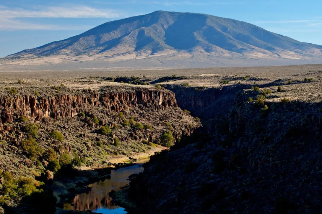
Did you know that the Rio Grande Gorge near Questa began, in a sense, with the Red River? Scientists with the Bureau of Land Management explain that about 400,000 years ago a closed basin in Colorado's San Luis Valley, holding a lake with no outlet, grew wetter and overflowed to the south. That water drained into the Red River, and as its volume increased it cut down through volcanic rock to form the modern Rio Grande Gorge. The Red River became a tributary, the Rio Grande took its headwaters in central Colorado, and the two rivers have met ever since in a canyon about 800 feet deep west of Questa.
Click to see more photos of the Wild Rivers country — the gorge, the confluence, and the monument lands near Questa
That meeting place is La Junta Point, inside the Wild Rivers Recreation Area. The Bureau of Land Management calls it one of the most dramatic views in the state, and the overlook above the confluence is wheelchair accessible. From the rim you look down on the Red River, flowing west out of the Sangre de Cristo Mountains, joining the larger Rio Grande between dark basalt walls. The canyon drops about 800 feet from rim to river, and the piñon and juniper forests on its slopes include trees about 500 years old, living witnesses to most of the human history of this valley.
Congress recognized how special these rivers were remarkably early. On October 2, 1968, the Wild and Scenic Rivers Act became law, and the Rio Grande in New Mexico was among the first eight rivers designated in the nation. The protected segment ran from the Colorado state line downstream and, importantly for Questa, it included the lower four miles of the Red River before it joins the Rio Grande. That means the confluence itself sits at the heart of one of America's first wild river protections. In 2013 the Wild Rivers Recreation Area became part of the new Rio Grande del Norte National Monument, adding another layer of care for the gorge and the plateau above it.
Anglers have treasured the lower Red River for generations. Fishing guides note that the best water runs from the confluence upstream to the Red River Fish Hatchery below Questa, where springs feed the river and keep winter water temperatures in the upper 40s to low 50s. Large cutbows move up out of the Rio Grande into the Red River during the colder months, and resident brown trout hold in the canyon water through the year. It is demanding country, reached by trails that descend hundreds of feet from the rim, and that effort is part of why the fishing here still feels wild.
That heritage needed help, and Questa answered. Trout Unlimited reports that by the end of 2014 the village had two miles of newly restored Red River, after the Questa Economic Development Fund and two Trout Unlimited chapters provided early funding that the New Mexico Department of Game and Fish leveraged into a 900,000 dollar restoration project. The work gave new life to a river that had served as a workhorse for decades. Today the confluence country remains both a working landscape and a protected one. The Bureau of Land Management notes that the La Junta Trail is closed until further notice, with access to the confluence reached by hiking the Little Arsenic or Big Arsenic trails, so the overlook at La Junta Point is the way most visitors greet the meeting of the rivers, standing where two wild rivers become one.