Sunday, November 8, 2026
Sunday arrives clear and cold in Questa, with a morning temperature of 28 degrees, sunshine through the day, a high near 57 degrees, and no weather alerts in effect. Sunrise came at 6:33 AM and sunset will be at 4:58 PM, leaving a bright, short November day that suits a slow walk through the village rather than a hurried drive through it. It is a good day to learn Questa on foot.
The best place to begin is the Questa History Trail, a half-mile walking route that starts where New Mexico highways 522 and 38 meet and loops through the historic church plaza and back to its starting point. Visitors start at the triangular Welcome sign and follow the red wooden arrows. The Questa Creative Council, which created the trail with a diverse team of residents, notes that the walk is generally easy but rough in places and not fully accessible, that almost all of its interpretive signs can also be reached by car, and that walkers should be respectful of residents and worshipers.
Those signs tell a much larger story than the short loop suggests. They move from thousands of years of Native settlements and trade routes, including the Kiowa Trail along the western face of the Sangre de Cristo Mountains, through the multicultural families who settled this valley again and again. Other signs explain the acequia system that governs the common use of precious water in the high desert, religious life in a village that went long stretches without a resident priest, the dramatic collapse of a church wall in 2008 and the years-long restoration that followed, and the way World War I and mining reshaped the village's future.
That layered history is Questa itself. The village was officially founded in 1842 as San Antonio del Rio Colorado, after a land grant requested from Mexico in 1841 was granted to 35 families in January 1842. A wall around the plaza offered protection to a settlement of sheep farmers and traders, and the thick-walled adobe church has stood at the center of the old plaza since the mid-1800s. Early family names included Rael, Cisneros, Ortiz, Armenta, LaForet, Kronig, Cruz, Beubien, Vigil, Trujillo, and Gallegos. When a post office was established in 1883, the intended name Cuesta, for the slopes around town, was misspelled as Questa, and the name stayed.
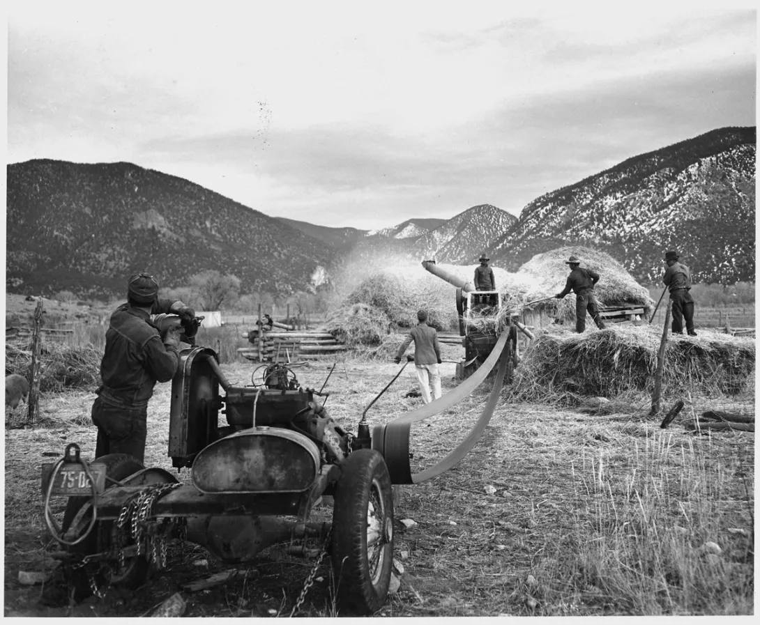
Farming shaped daily life as surely as faith did, and it still does. Agriculture in Questa depends on irrigation water from the Red River and Cabresto Creek, carried by acequias whose two major ditch associations, the Acequia Madre and the Llano ditch, control distribution from Cabresto Lake. The burning of the ditches on the first weekend after the vernal equinox remains a major community event, a reminder that in this valley water, work, and neighborliness have always been shared. The historic photograph with this article, showing wheat being threshed by machine in Questa, captures that same cooperative spirit in an earlier generation's harvest.
The trail's creators say it supports Questa's shift from a mining town toward a broader economy built on cultural preservation, sharing local history and surrounding beauty with visitors, residents, and homecoming family alike. It was one of the founding projects that led to the nonprofit Questa Creative Council. On a clear Sunday like this one, walking it is both a history lesson and a homecoming, whether you have lived in Questa all your life or are seeing the plaza, the church, and the slopes above town for the first time.