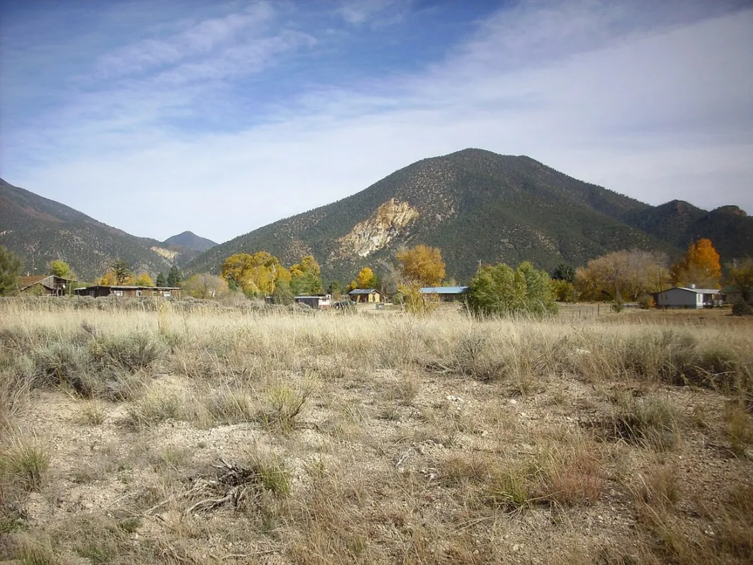
Look toward Eagle Rock, at the mouth of Red River Canyon near Questa, and you can spot a patch of pale, light yellow rock against the darker forested slope. That exposure is the Amalia Tuff, and it tells one of the biggest stories in northern New Mexico geology. This light colored rhyolite is not a quiet lava flow. It is welded volcanic ash, packed so hot and so densely when it settled that it fused into solid rock, and it came from an eruption large enough to reshape the country around Questa.
Click to see more photos of the Amalia Tuff
The Amalia Tuff belongs to the Latir volcanic field, the chain of volcanoes that was active in the Sangre de Cristo Mountains near Questa from about 28 million to 22 million years ago. Geologists with the United States Geological Survey describe how a large body of magma grew beneath the field, then broke through about 25 million years ago and erupted roughly 500 to 1,000 cubic kilometers of alkali rich rhyolite ash flows. The flows spread outward as a densely welded sheet, with remnants still preserved as far as 45 kilometers beyond their source. When the emptied magma chamber collapsed, it formed the Questa caldera, a sunken volcanic basin at least 14 kilometers across, whose deeply eroded interior still surrounds the Red River Canyon country today.
Learning to recognize the Amalia Tuff is a fine beginner exercise, because welded tuff rewards a close look. From a distance it can be mistaken for a rhyolite lava flow, since the ash welded into a hard, dense rock. Up close, studies published by the New Mexico Bureau of Geology and Mineral Resources describe flow banding, flattened pumice fragments, and visible crystals of quartz and the feldspar mineral sanidine set through the rock. The colors tend toward light gray, pale yellow, and tan rather than the deep black of the younger Servilleta Basalt in the Rio Grande Gorge. Where you see pale, banded, crystal flecked volcanic rock in the hills around Questa and toward Amalia, the village that gives the formation its name, you are likely looking at this tuff.
The story did not end with the eruption. About two million years later, hot fluids connected with cooling granite bodies along the south margin of the caldera deposited the rich molybdenum mineralization east of Questa, the deposit that became the Questa mine and shaped the working lives of generations of local families. That mining heritage is part of this story, but the mine area is not a collecting site, and this feature names no collecting location. Think of the tuff instead as a rock to read in place, in canyon walls and natural exposures, where its bands and crystals record the day a mountain sized volume of ash raced out of the Questa caldera.
Know before you go: Collect only where collecting is legal. This article names no collecting site, because no site near Questa was verified this week. On Bureau of Land Management land, the Bureau generally allows visitors to collect reasonable amounts of rocks, minerals, and gemstones for personal use, not for sale or barter, using hand tools with only minor surface disturbance. Collecting is not allowed in developed recreation sites such as campgrounds and picnic areas unless otherwise permitted, and it is prohibited on existing mining claims without the claim holder permission. Cultural items are protected by federal law and must never be removed. Always respect private land and posted closures, check with the local Bureau of Land Management office before collecting, and pack out everything you pack in.